(Mis)communication: ‘Misleading info from India aggravated flood losses’
Encroachments on storm drains should be removed to mitigate flood damages

(Mis)communication: ‘Misleading info from India aggravated flood losses’
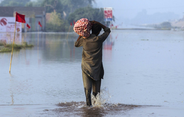
Misleading information provided by India regarding water flows in Rivers Chenab and Jhelum resulted in aggravating damage in 14 districts during floods this year, a post-flood report of the Irrigation and Power Department says.
High floods hit the two rivers between September 5 and 17 inundating 1,241 villages and 2.1 million acres of land in 14 districts. As many as 248 people lost their lives in the calamity.
India is required under the Indus Waters Treaty to provide information on all gauges and discharges on Rivers Ravi, Sutlej and Beas, Chenab and Jhelum during the flood season, says the report, a copy of which is available with The Express Tribune.
However, it says, India provided confusing data to the Pakistan Commissioner of Indus Waters.
The department recommended that the issue be taken up with Indian authorities to avoid such losses in the future.
It said encroachments in drains also added to flood losses.
Palkhu Nullah enters the province at Line of Control (LoC) near Vains village in Sialkot – it drains out into River Chenab at Khanki Headworks. The stream has a discharge capacity of 1,980 cusses. This year it received up to 48,500 cusecs during the flood season, the report says.
Aik Nullah enters the province through Umeranwali village of Sailkot. It discharges water into Palkhu Nullah. The discharge capacity of the drain is 20,000 cusecs; it received 44,386 cusecs on September 6.
Old bridges, a siphon, a super passage and encroachments proved bottlenecks in flow of water and caused a flood in Sialkot, Daska, Sambrial and Wazirabad, the report says.
Deg Nullah originates in Jammu and Kashmir near Lehri and enters Pakistan at Jangu tehsil of Zafarwal.
Its discharge capacity is about 12,000 cusecs but it received 75,000 cusecs at Kingra Bridge on September 6.
The flood from the drain inflicted huge losses in Zafarwal, Pasrur, Daska, Kamoke, Muridke, Ferozwala and Sheikhupura.
The department has recommended that flood forecast system be improved. It has also called for enhancing the capacity of storm drains.
It has said maintenance of flood protection works should be given due importance in resources allocation irrespective of frequency of floods. The government should use modern technology to check the health of flood embankments, the report says.
It stresses the need for an effective liaison among the Provincial Disaster Management Authority, the Irrigation and Power Department, the WAPDA, district administrations, the army, police, the National Highway Authority, Pakistan Railways and public representatives to avert flood losses.
The department has also recommended that river engineering and flood management should be taught at universities to better deal with flood disasters in the country.
Published in The Express Tribune, December 7th, 2014.


COMMENTS
Comments are moderated and generally will be posted if they are on-topic and not abusive.
For more information, please see our Comments FAQ