Capacity building: ‘The only consistent thing about our rivers is their inconsistency’
Researchers, officials learn about flood modelling and risk mapping techniques.
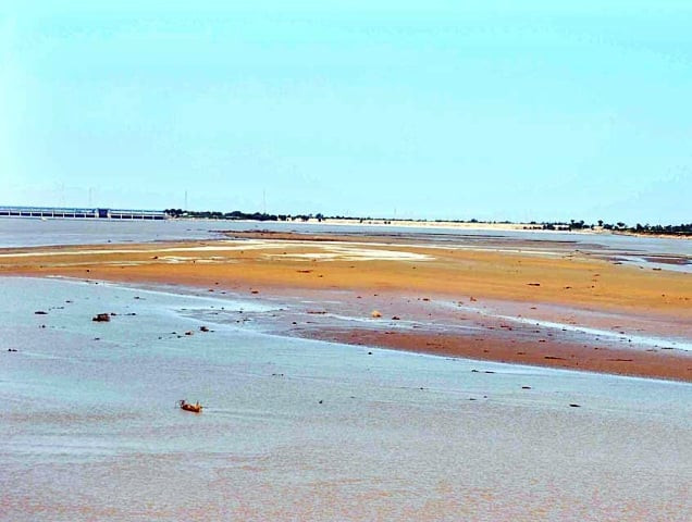
Lessons from an ongoing Unesco project, started after the 2010 floods, can help Pakistan avoid devastation in future.
This is the aim behind a two-day workshop that started here on Thursday. On the first day, government officials, researchers and academics got to learn about flood modelling and risk mapping techniques.
The workshop, organised by the Space and Upper Atmosphere Research Commission (Suparco) and its project partners, aims to share the knowledge of a project started by Unesco following the 2010 floods. The Unesco project aims to enhance flood forecasting capabilities and hazard mapping of flood plains along the Indus River.
Funded by the government of Japan, the ongoing project is being implemented by Suparco in collaboration with the Japan International Cooperation Agency, the National Disaster Management Authority and the Pakistan Meteorological Department.
The project, which started in 2011, focuses on building the capacity of Pakistan’s flood forecasting and early warning infrastructure using remote sensing and Geographic Information System (GIS) technologies for flood assessment, management and decision support. (Remote sensing is the use of satellite technology to measure information on the Earth’s surface and GIS is an information system which can store and analyse georgraphical data.)
The project aims to use these space science technologies, such as satellite measurements of rainfall, together with complex analysis techniques to form a real-time flood early warning system.
Such a forecasting system, complete with maps of areas at the risk of inundation, will help authorities evacuate people from the flood-prone areas before disaster strikes.
During the technical sessions on Thursday’s workshop, experts from Japan, China and Australia shared their knowledge on risk assessment models and the performance of these models using data from Pakistan.
Shahbaz Khan, deputy director of Unesco’s Regional Science Bureau for Asia and the Pacific, said there is a need to take the scientific knowledge to the common man.

“There is a need for collaboration between scientists and the community at large,” Khan said.
In the final session of the day, Ahmad Kamal, chief engineer at the Flood Forecasting Commission of Pakistan, listed around 15 future needs, including an urgent flood control plan for the country, revision of river flood classifications and addressing deficiency in forecasting flash floods.
Earlier, chief guest Kamal Majidullah, special assistant to the prime minister on water resources and agriculture, said Pakistan needs to come to terms with the erratic behaviour of its rivers.
“The only thing consistent about our rivers is their inconsistency,” he said, indicating that the rivers discharges have varied greatly over the years. “We need to understand this phenomenon.”
Japanese Ambassador Hiroshi Oe, during his keynote address, said Japan has been helping Pakistan bolster its disaster management capabilities. “It is better if we could prevent or reduce flood damage in the first place,” Oe said.
“Because of its own long history of natural disasters, Japan has advanced disaster preparedness and management technology,” he said. “We want to share our experience to strengthen the flood management capacity of Pakistan.”
The workshop will continue on Friday with five technical presentations. It was preceded by a three-day training of the participants on remote sensing, GIS and flood analysis models. It will be followed by a day-long training session led by foreign experts.
Published in The Express Tribune, December 14th, 2012.







COMMENTS
Comments are moderated and generally will be posted if they are on-topic and not abusive.
For more information, please see our Comments FAQ