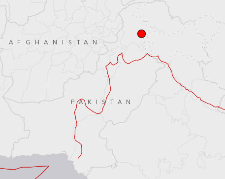
According to the United States Geological Survey, the earthquake measured 5.4 on the Richter scale and had an epicentre 100 kilometers north-north east of Islamabad and at a depth of 24.2 km.
The quake was strong enough to prompt many people to evacuate their homes in panic.
Fortunately, there were no reports of any loss of live or property.
The epicentre of Friday's earthquake was just 19 kilometers north of Baffa, close to Balakot where a 7.6 magnitude temblor struck in 2005 killing at least 75,000 people.
https://twitter.com/Faraankhan/status/571070934712348673
https://twitter.com/saffism/status/571068213867388929
Magnitude of earthquake was high.sound of a blast woke me up from a sound sleep then I felt tremors .
— Tanzeela Mazhar (@TenzilaMazhar) February 26, 2015
The area where the quake took place lies near a fault line. Seismicity in the Himalaya mostly results from the continental collision of the India and Eurasia plates, which are converging at a relative rate of 40-50 mm per year.
Northward underthrusting of India beneath Eurasia generates numerous earthquakes and consequently makes this area one of the most seismically hazardous regions on Earth.


1730752226-0/Untitled-design-(35)1730752226-0-165x106.webp)


1726140338-01730723472-0/Untitled-design-(42)1726140338-01730723472-0-270x192.webp)


1730706072-0/Copy-of-Untitled-(2)1730706072-0-270x192.webp)
COMMENTS (5)
Comments are moderated and generally will be posted if they are on-topic and not abusive.
For more information, please see our Comments FAQ