Flood fears mount in twin cities
Historical flood pattern returns; evacuations begin in vulnerable areas
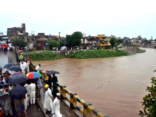
The monsoon flood season is set to reach its critical phase in the twin cities of Rawalpindi and Islamabad starting today (Wednesday).
Historical data spanning the last 71 years reveals that all major floods in the region have occurred between July 17 and July 27. The first 15 days of the traditional Sawan season, beginning July 16, are considered the most perilous in terms of flood risk. By the start of August, the likelihood of catastrophic flooding typically declines.
Between July 16 and July 31, every intense downpour poses a serious threat of urban flooding in low-lying neighborhoods, streets, and roadways.
With the onset of Sawan, residents living along the 22-kilometer-long Nullah Leh and the banks of 15 rain-fed tributaries — winding through the city like serpents — have already begun precautionary evacuations.
Residents from approximately 19 vulnerable communities have either relocated entirely or transferred only their valuable belongings to safer locations, leaving behind basic necessities. When water levels rise, these families move swiftly to higher ground and return as soon as the water subsides — often within a few hours — to begin cleaning and restoring their homes.
Historically, Nullah Leh was a pristine stream fed by natural springs and rainwater flowing from the Margalla Hills of Islamabad. It entered Rawalpindi near New Katarian and eventually emptied into the River Soan. The area was originally settled by the Aryan community, drawn by the clean water and dense forests.
To this day, their legacy remains in names such as Arya Mohalla, located near Liaquat Bagh Chowk. Until 1925, the stream's waters were crystal clear — used for ablution, drinking, washing clothes, and Hindu religious rituals. Cremated remains were also immersed in its waters. According to local elders, the stream was once home to fish, which the Aryans would catch.
However, following the Partition in 1947, this once-pristine waterway began to deteriorate. With Rawalpindi's industrialization and the rapid development of Islamabad as the federal capital, the stream steadily turned into a polluted drain. Today, Nullah Lai and its tributaries function as open sewage channels, overflowing and causing destruction with each monsoon season.
Nullah Lai spans 22 kilometers, with a width ranging from 500 to 1,000 feet. Of its total length, 11 kilometers run through urban Rawalpindi, with the remainder passing through cantonment areas. The deadliest flood in its history occurred on July 23, 2001, when surging waters claimed 65 lives and 300 domestic animals. Commercial sectors suffered losses estimated at Rs. 7 billion. Many traders who were millionaires the day before found themselves destitute overnight — and some families have yet to recover, even 24 years later.
The first recorded flood in Nullah Lai occurred in 1967 during General Ayub Khan's era. The second followed in 1969 under General Yahya Khan, resulting in three fatalities. The third struck in 1972 during Prime Minister Zulfikar Ali Bhutto's government, taking 10 lives. Further floods occurred in 1975, 1982, and 1986, after which monsoon flooding became a nearly annual crisis.












COMMENTS
Comments are moderated and generally will be posted if they are on-topic and not abusive.
For more information, please see our Comments FAQ