Heavy rain and snow forecast for Southern California’s burn-scarred region
A weekend storm in California may bring much-needed rain but also flood risks.
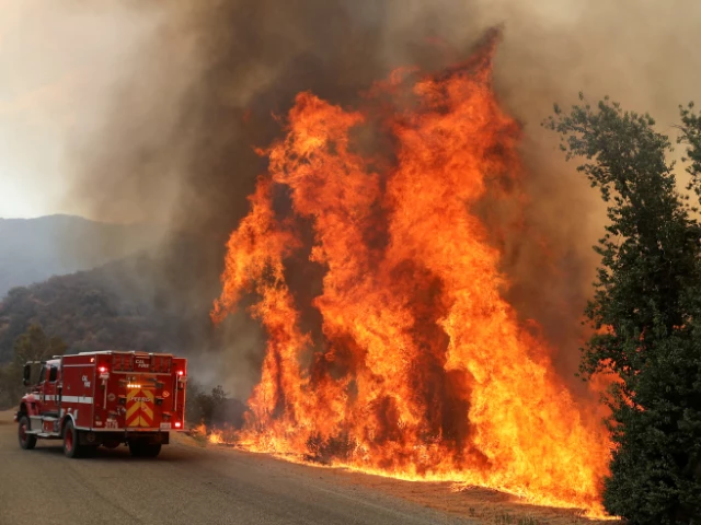
A winter storm set to hit Southern California this weekend is expected to bring much-needed rain and snow, potentially extinguishing ongoing wildfires. However, it has also prompted flood watches for burn-scarred areas, raising concerns about flash floods and mudslides.
The National Weather Service (NWS) issued flood watch alerts for parts of Los Angeles County, including regions affected by the Palisades Fire and Eaton Fire. These areas, which have endured hurricane-force winds and dry conditions, face a heightened risk of debris flows. The alerts take effect at 4 p.m. Sunday.
The Palisades Fire has burned over 23,000 acres and is 79% contained, while the Eaton Fire, burning more than 14,000 acres, is 95% contained. The burn scars left behind from these and other fires, such as the Hughes Fire in Angeles National Forest, pose significant flood risks.
“While damaging debris flows are not the most likely outcome, the threat is high enough to prepare for the worst-case scenario,” the NWS office in Oxnard stated.
Rain is expected to start Saturday afternoon, with heavier showers forecast for Sunday. Urban Los Angeles could see up to a quarter-inch of rain, while San Diego might receive as much as an inch.
In addition to rain, snow is forecast for Southern California's mountains, with winter storm warnings issued for the San Gabriel and San Bernardino ranges. Snow accumulation could reach up to 18 inches at elevations above 6,000 feet, while areas above 4,000 feet may see up to 6 inches.
The vital Interstate 5 Grapevine area could experience light snow, potentially causing travel disruptions. Even urban mountains in Los Angeles and San Diego counties could see significant snowfall, with 14 inches and 8 inches expected, respectively.
The Border 2 Fire in San Diego County, which has burned over 6,000 acres since Thursday, remains only 10% contained as of Friday evening.
This year has been one of extremes for Southern California. The NWS office in San Diego reported that rainfall since October has been the lowest since records began in 1860. However, the anticipated storm could bring much-needed relief.
Temperatures are expected to drop by 10 to 15 degrees over the weekend, marking a sharp contrast to recent warm days. Sandbags are being offered to residents in cities like Los Angeles and Pasadena to prepare for possible flooding.
Federal forecasters estimate a 10% to 20% chance of significant flooding or debris flows in affected areas. While the storm offers hope for ending wildfires, it also presents challenges for communities recovering from months of dry weather and relentless blazes.













COMMENTS
Comments are moderated and generally will be posted if they are on-topic and not abusive.
For more information, please see our Comments FAQ