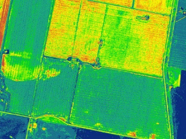
Pakistan to use satellite for crop mapping
13-colour imagery will help identify crop data, seed quality and growth

PHOTO COURTESY: abc.net.au
Information Technology University (ITU) founding Vice Chancellor and Punjab Information Technology Board (PITB) Chairman Dr Umar Saif said during an interview with a private television channel on his project “Food@Home” on Friday.
Pakistan becomes first country to use multi-spectral imagery for crop mapping
Dr Saif said there was no dependency on anyone for crop mapping as was the case in the past. He said that previously, people would use android phones to report the GPS location through which Google provided a three-metre resolution in black. On the other hand, Sentinel-2 A, which passes over Pakistan once a week, will give 13-colour imagery to help identify crop data, including seed quality, growth, disease, the area of cultivation, yield, impact on the economy and determine export potential of excess crop,” he said.
“After two years of research and development, we are launching Punjab’s agriculture crop maps, generated automatically using machine learning on multi-spectral satellite imagery. The system gives weekly data about the yield of 26 crops across Punjab. We were making our maps freely available, which could be accessed by installing the machine-learning algorithms on your computer,” he asserted.
Govt aims for varieties, hybrids of crops
Dr Saif said the digitalised data would help in market facilitation, stability, direct interest-free loans to small farmers from banks and subsidy without involving middleman.
Other users such as government to formulate agriculture policy, insurance companies, agriculture departments and industry could benefit from the data gathered in real time.
Published in The Express Tribune, September 1st, 2018.


COMMENTS
Comments are moderated and generally will be posted if they are on-topic and not abusive.
For more information, please see our Comments FAQ