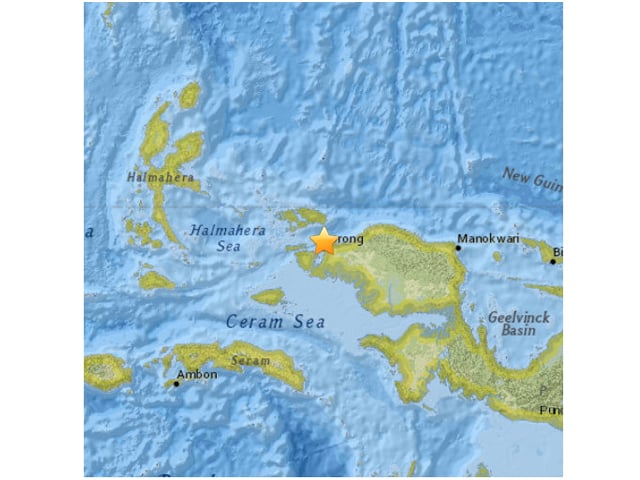
The undersea quake hit at a depth of 24 kilometres (14 miles) at about 1:00 am (1600 GMT), 30 kilometres from Sorong, in West Papua province, the US Geological Survey said.
Prelim M6.6 earthquake NEAR N COAST OF PAPUA, INDONESIA Sep-24 15:53 UTC, updates http://t.co/ZyB3ewKrod
— USGS Earthquakes (@USGS_Quakes) September 24, 2015
The USGS initially put the quake's magnitude at 6.9 but then revised it down.
The Pacific Tsunami Warning Center said there was no threat of a tsunami. There was no immediate information on whether the quake had caused casualties or damage.
Read: Moderate 5.4-magnitude earthquake rocks Tokyo
Indonesia sits on the Pacific "Ring of Fire", where tectonic plates collide, causing frequent seismic and volcanic activity.
In July, a teenage boy fell into a river and died and several buildings were damaged when a 7.0-magnitude quake rocked Papua.
A huge undersea quake in 2004 triggered a tsunami that engulfed Aceh province on western Sumatra island, killing more than 170,000 people in Indonesia and tens of thousands more in other countries with coasts on the Indian Ocean.


COMMENTS
Comments are moderated and generally will be posted if they are on-topic and not abusive.
For more information, please see our Comments FAQ