Urban sustainability: If you don’t want Karachi to flood in the next rains, do this
A flood defense and response system and risk mapping are some solutions.

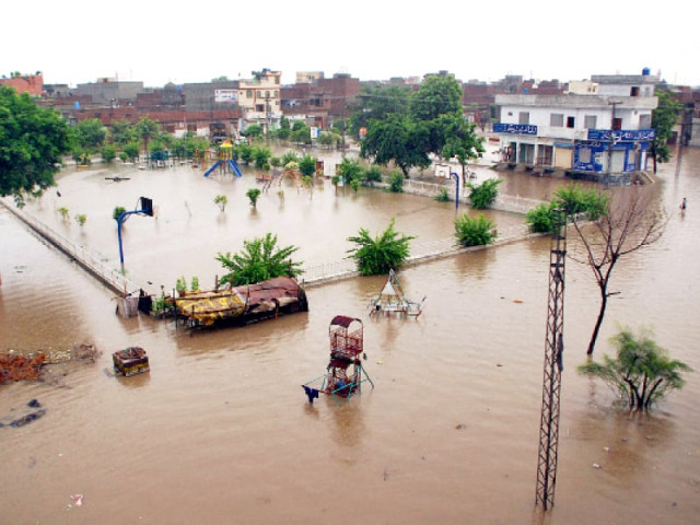
It is critical to have an integrated flood reporting and response mechanism. We need to strengthen the city’s ability to respond to an emergency (health, emergency, trauma facilities, fire services, law and order services). PHOTO: FILE.
There are three ways Karachi can prepare itself for flooding. Indeed, the rains in the last few weeks have renewed the debate on why this happens and what we can do about it. Despite the fact that the city’s average rain patterns have not significantly changed over the years and we don’t get frequent bouts of rain, we still have experienced some severe flooding in the past.
As a solution, cities can undertake effective spatial planning to avoid the creation of flood-vulnerable land use in high risk areas and identify areas to resettle and relocate people. In Karachi, a large portion of the population is at high risk because they live in either squatter settlements or in low-lying localities and hill settlements.
Another preventive mechanism involves the construction of flood defenses and drainage systems. But other than the 12-mile-long Malir River Embankment (constructed as a response to the 1977 floods when Korangi Industrial Area was totally inundated) no other flood defense mechanism exists.

Karachi’s network of drains is not designed to handle high intensity of rainfall. In addition, the drains get blocked or are covered up by encroachments. This happens, for example, when sewage lines are connected to drainage networks and garbage is dumped in them. But none of this is news. As far back as three decades ago, experts realised that encroachments and squatter settlements on the bed and along the banks of the Malir River were a major cause of flooding in 1977. We have known this for a long time.
One solution used globally by city planners is to invest in flood storage areas - designing some areas to deliberately flood (such as parks) so that vulnerable land can be spared. But none of the authorities consider using this technique. And meanwhile, the green spaces that are available for it are vanishing fast.
As for the sources and types of flooding, Karachi can be hit by fluvial flooding via the Malir and Lyari rivers and their tributaries. There can be surface water flooding in which heavy rainfall overwhelms the drains and sewers which overflow. And as a coastal city, Karachi can also be prone to tidal flooding if the sea level rises or there is a tidal storm or hurricane.
When trying to assess the risk of flooding, experts look at the probability of a flood occurring, the consequence and associated risk and vulnerability of people and assets that may be affected.

Probability is then linked with the establishment of a Flood Risk Zone. Vulnerability factors can then be combined to produce an index of flood vulnerability which can be plotted using census data. The only such work in this area, partially, has been done by WAPDA in a 1990 ‘Feasibility Report on Malir River Basin’. But while it calculated surface runoff, it did not specify a flood plain for the Malir river basin. We can safely assume that a large number of human settlements, a majority housing vulnerable communities, reside in possible flood risk zones. Similarly, despite a lack of accurate data, we can just consider the industrial assets that are quite possibly located in a likely flood risk zone. It should come as a sobering realisation that the Sindh Industrial Trading Estate, the FB Area Industrial Zone, the North Karachi Industrial Zone and the Landhi and Korangi Industrial Trading Estates are located right along the Lyari and Malir rivers.
Karachi needs flood risk maps, a flood risk zone and a surface water management plan. The authorities should strictly prevent people from living on the river beds, hills and from encroaching on drains. There has to be a focus on increasing the city’s ‘green cover’ to act as support drainage basins to protect against river-based and tidal flooding as well. Thought needs to be given to increasing the resilience of vulnerable communities or people living in areas that could flood.

It is critical to have an integrated flood reporting and response mechanism. We need to strengthen the city’s ability to respond to an emergency (health, emergency, trauma facilities, fire services, law and order services). We need to think about shelters, have an evacuation plan. We need to be prepared for the next time. It is about time.

The writer is an urban planner and runs a Karachi-based non-profit organisation that focuses on urban sustainability
Published in The Express Tribune, August 15th, 2013.


COMMENTS
Comments are moderated and generally will be posted if they are on-topic and not abusive.
For more information, please see our Comments FAQ