New boundaries: Map of the proposed district in Hazara sent to K-P govt
Tanawal district, if approved, will be the third largest in the division.
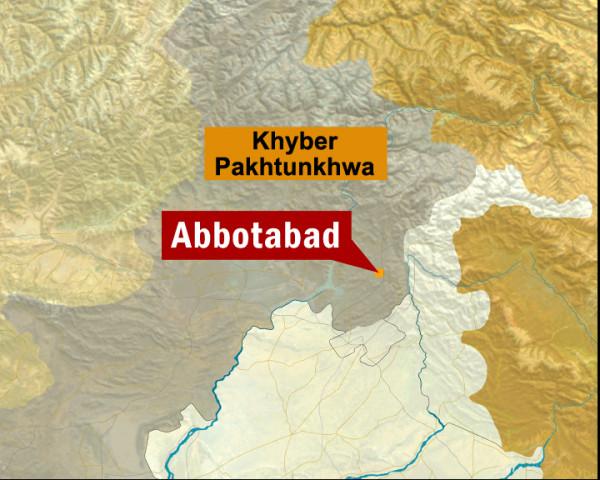
A map of the proposed Tanawal district in Hazara division, along with a unanimous resolution by former nazims and notables of the area endorsing its creation, was sent to the provincial government on Wednesday.
The map was prepared by revenue officials and former local government representatives. Former nazims, naib nazims and notables from 27 union councils of Abbottabad, Mansehra and Haripur, signed the resolution, five-time member national assembly from Mansehra, Nawabzada Salauddin Saeed told The Express Tribune.
He explained that the proposed seventh district of Hazara would include union councils from Mansehra, Abbottabad and Haripur districts.
The new district will comprise three tehsils and its population will be around 800,000. It will be the third largest district in the division after Torghar and Kohistan and will comprise 95 per cent of the Tanoli tribe, added Saeed, a great-grandson of Nawab Khani Zaman of Amb, a former princely state.
Giving details, he said that union councils Lasan Nawab, Sawan Mera, Phulra, Parhina, Sher Garh, Nika Pani, Bandi Shungal, Krohri, Ashnaya, Darband, Jalu, Bihali, Lasan Thakral and Data will be taken from Mansehra district; Sherwan, Pawa, Pind Kargu Khan, Kuthiala, Chamhad and Jarral from Abbottabad district; and Bait Gali, Ladarmang, Kalinjar, Beer, Sera-e-Nehmat Khan, Pind Hasham Khan and Jati Pind from Haripur district.
An official of the revenue department said that preliminary work on the proposal is almost complete, adding that the provincial government and the civil administration of Hazara were serious about carving out the seventh district out of three existing districts.
He confirmed that correspondence is underway between the divisional administration and the provincial government for the project.
Published in The Express Tribune, April 5th, 2012.








COMMENTS
Comments are moderated and generally will be posted if they are on-topic and not abusive.
For more information, please see our Comments FAQ