'Inaccurate' maps of India, Pakistan taken off US State Dept website
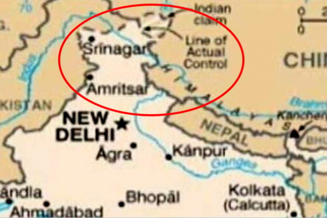
The maps failed to show the divided territory of Kashmir as disputed, reports BBC.

The maps did not highlight the divided territory of Kashmir as disputed.
According to a report by Indian news agency Press Trust of India (PTI), India contacted the US State Department on Monday to correct the maps that were showing the disputed territory of Kashmir as a part of Pakistan.
The US State Department, in response, removed the maps on Tuesday, as the state department spokesperson Victoria Nuland confirmed that the maps had "some inaccuracies which were associated with the boundaries of some geographic features" the BBC report cited.
"We will put up the new map when we acquire one that we are confident is accurate," she said.
The report by PTI also quoted the US Embassy spokesperson in India as saying that the errors in the maps were not intentional and were "not meant to represent the same precision and intricacies of professional or scientific map."
This is not the first incident of India protesting against an incorrect map of their territory as earlier a Chinese brochure about an investment in India showed the state of Arunachal Pradesh as part of China and also challenged India’s claims in the Kashmir region.
On another occasion, the book of Pakistan Tehrik-e-Insaf leader Imran Khan also printed an incorrect map of Kashmir, but the publication was taken back within a week for correction and the advance copies of the book in India were also recalled before any official complaint could be launched.


COMMENTS
Comments are moderated and generally will be posted if they are on-topic and not abusive.
For more information, please see our Comments FAQ