PM Shehbaz arrives in Peshawar for apex committee meeting, security briefing
Updated 4 hours ago

Expensive monitoring tools limit data reliability
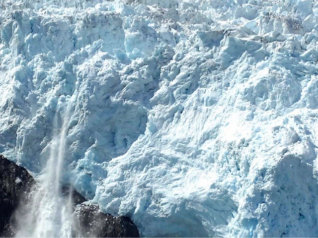
The rate of glacier area loss in the Karakoram Highway region had increased from 3.2 per cent in the 1990s to 4.9 pc during 2010-2020, while Karakoram glaciers had declined by around 12pc between 1990 and 2020.
The startling fact was revealed in the Senate Standing Committee on Climate Change on Tuesday.
Officials informed the committee that there were 115 potentially dangerous glacial lakes, of which 105 had unfrozen as of Aug 5.
They said reliable data on the rate of glacier melt in Pakistan remained limited because glacier monitoring was an expensive exercise.
Federal Minister for Climate Change and Environmental Coordination Dr Musadik Malik glacier melt and flooding were two different phenomena and required different responses.
"Dams can help control floods, but glaciers cannot be stopped," he said, adding that glacier-related disasters could involve movement of land and terrain and were therefore not simply a matter of water flow.
The minister said the government was exploring the use of digital twinning for better understanding and modelling of climate- and glacier-related risks. He also stressed the need for establishing a digital laboratory.
Dr Malik said glaciers were disappearing across the region at an estimated rate of around 9 pc.
The minister said data from areas where conventional monitoring was difficult was increasingly being obtained through satellite systems.
He said towers had also been installed at locations where data was previously unavailable.
The climate change minister told the committee that Pakistan needed a coordinated mechanism under which relevant departments could automatically share data instead of waiting for formal requests from one another.
He said Prime Minister had constituted a committee under the Ministry of Defence to bring relevant departments and institutions onto a common platform.
Dr Malik said a virtual platform had already been developed as part of efforts to integrate available information.
He said glacier and water systems were dealt with by the Ministry of Water Resources, while the Water and Power Development Authority (Wapda) was responsible for devices monitoring snowfall and glacier melt.
Early warning systems, he said, fell under the Ministry of Defence, satellite data was handled by the Pakistan Space and Upper Atmosphere Research Commission (Suparco), while disaster-related matters were dealt with by the National Disaster Management Authority (NDMA).
"Whether civilian or defence-related, satellite data is with Suparco, while disaster management is the responsibility of NDMA. We need to bring these systems together so that the country can receive integrated and timely data," the minister said.
Dr Malik said the government was also working towards establishing a new authority to deal with civilian weather-related matters. The proposed authority, he said, would also serve as the Ministry of Climate Change and Environmental Coordination's think tank.
He added that proposals in this regard would be finalised and presented before the federal cabinet shortly.














This material may not be published, broadcast, rewritten, redistributed or derived from. Unless otherwise stated, all content is copyrighted © 2026 The Express Tribune.








COMMENTS
Comments are moderated and generally will be posted if they are on-topic and not abusive.
For more information, please see our Comments FAQ