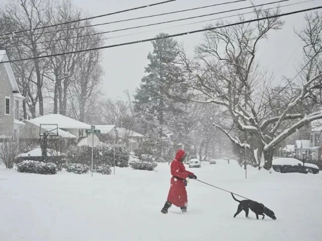
Polar vortex to bring bitter cold and snow across the US
Nearly 300M Americans face an arctic blast with sub-zero wind chills, heavy snow, and record-low temperatures ahead

A polar vortex is set to plunge much of the continental United States into frigid temperatures and snow in the coming days. Nearly 300 million Americans are bracing for an arctic blast that will bring sub-zero wind chills, heavy snow, and record-low temperatures to several regions, according to the National Weather Service (NWS).
The cold front will sweep southward through the Plains and Midwest before expanding to the South and Northeast, with temperatures forecasted to be 15–30°F below average. Some cities may experience their coldest temperatures of the season.
Great Lakes and Midwest
Chicago and Illinois: Wind chills of -15°F to -25°F are expected, with highs in the single digits and sub-zero lows persisting into early next week. Lake-effect snow may bring additional flurries.
Minnesota: Minneapolis could record its first double-digit subzero lows of the season starting Sunday, with multiple nights of frigid temperatures.
Northeast
Boston, New York, and DC: The Interstate 95 corridor is forecasted to experience lows in the single digits by Tuesday morning. Washington, DC, could see up to six inches of snow, while Massachusetts may receive two to four inches. Sub-zero wind chills will dominate the region.
South
Georgia and Florida: Northwest Georgia has a 50% chance of snow this weekend. In Florida, temperatures will dip below seasonal averages, with some areas nearing freezing.
Texas: North Texas, particularly areas north of Dallas-Fort Worth, has a chance of snow accumulation exceeding 0.1 inches.
Central plains
Kansas and Missouri: Northeastern Kansas to north-central Missouri has already seen up to 15 inches of snow, with more cold weather expected.
Wind chill hazards
Sub-zero wind chills will impact large swathes of the Plains, Midwest, and Great Lakes, with some areas experiencing dangerous early-morning chills of -20°F to -40°F. Teens and single-digit wind chills will extend as far south as the Gulf Coast.
Persistent cold patterns
While not widespread record-setting, January's cold has been persistent. NOAA data shows temperatures have been below average for much of the US east of the Rockies, with the South, Plains, and mid-Atlantic particularly affected.
Preparation
Residents are urged to stay informed through local weather updates, as the polar vortex is expected to disrupt travel and create hazardous conditions.


COMMENTS
Comments are moderated and generally will be posted if they are on-topic and not abusive.
For more information, please see our Comments FAQ