Fire raging near Ukraine's Chernobyl nuclear plant
A second fire, stretching across 12,600 hectares, was just one kilometre away from the defunct plant

An aerial view shows a forest fire in the 30 km (19 miles) exclusion zone around the Chernobyl nuclear power plant, Ukraine, April 12, 2020, in this still picture taken from video. Photo: Reuters TV/via REUTERS
Ukraine’s Emergency Situations Service said it was still fighting the fires, but that the situation was under control.
Video footage shot by Reuters on Sunday showed plumes of black smoke billowing into the sky and trees still ablaze, with firefighters in helicopters trying to put out the fires.
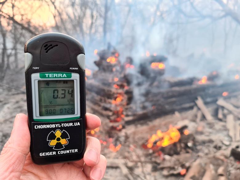 A geiger counter measures a radiation level at a site of fire burning in the exclusion zone around the Chernobyl nuclear power plant, outside the village of Rahivka, Ukraine. Photo: Reuters
Aerial images of the 30 km (19 mile) exclusion zone around the plant, site of the world’s worst nuclear accident in 1986, showed scorched, blackened earth and the charred stumps of still smouldering trees.
The Emergency Situations Service said radiation levels in the exclusion zone had not changed and those in nearby Kiev, the Ukrainian capital, “did not exceed natural background levels”.
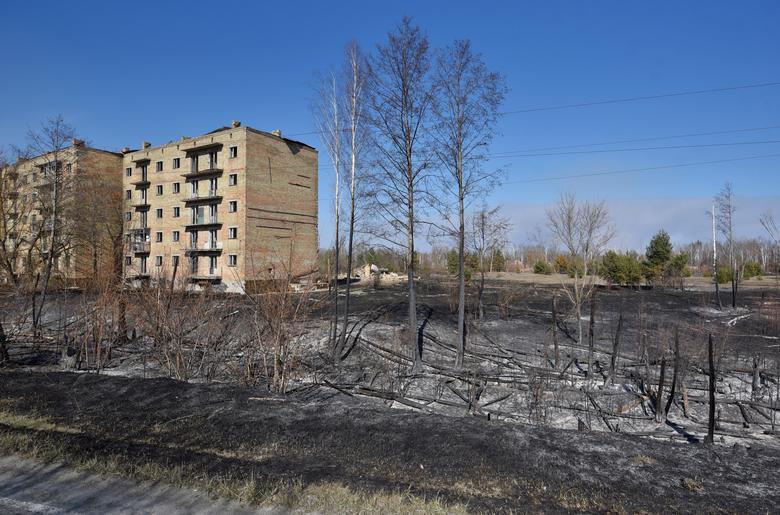 Burned trees are seen in the settlement of Poliske after a forest fire in the exclusion zone around the Chernobyl nuclear power plant, Ukraine, April 12. Photo: Reuters
Greenpeace Russia said the situation is much worse than Ukrainian authorities believe, and that the fires cover an area one thousand times bigger than they claim.
On April 4 Ukrainian authorities said the blaze covered an area of 20 hectares, but Greenpeace cited satellite images showing it was around 12,000 hectares in size at that time.
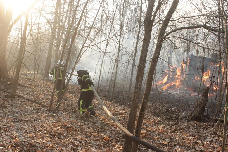 Firefighters try to extinguish a fire burning in the exclusion zone around the Chernobyl nuclear power plant, April 10. State Emergency Service of Ukraine in Kiev region. Photo: Reuters
“According to satellite images taken on Monday, the area of the largest fire has reached 34,400 hectares,” it said, adding that a second fire, stretching across 12,600 hectares, was just one kilometre away from the defunct plant.
Ukrainian officials did not immediately respond to a request for comment on those claims.
Rashid Alimov, head of energy projects at Greenpeace Russia, said the fires, fanned by the wind, could disperse radionuclides, atoms that emit radiation.
“A fire approaching a nuclear or hazardous radiation facility is always a risk,” Alimov said. “In this case we’re hoping for rain tomorrow.”
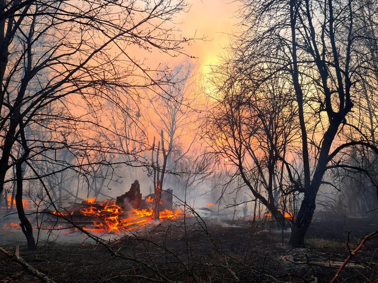 Firefighters try to extinguish a fire burning in the exclusion zone around the Chernobyl nuclear power plant, April 10. State Emergency Service of Ukraine in Kiev region. Photo: Reuters
Chernobyl tour operator Yaroslav Yemelianenko, writing on Facebook, described the situation as critical.
He said the fire was rapidly expanding and had reached the abandoned city of Pripyat, two kilometers from where “the most highly active radiation waste of the whole Chernobyl zone is located”. He called on officials to warn people of the danger.
Satellite images taken by NASA Worldview and seen by Reuters showed the two fires had extended far into the exclusion zone.
The fires, which follow unusually dry weather, began on April 3 in the western part of the exclusion zone and spread to nearby forests.
Police say they have identified a 27-year old local resident who they accuse of deliberately starting the blaze.
It remains unclear if the person, who has reportedly confessed to starting a number of fires “for fun”, is partly or fully responsible.




COMMENTS
Comments are moderated and generally will be posted if they are on-topic and not abusive.
For more information, please see our Comments FAQ