New Zealand cancels tsunami alert after powerful quake
As a 7.2-magnitude earthquake stuck near the remote Kermadec Islands in the country's northeast

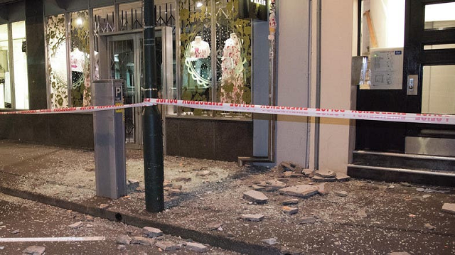
The earthquake was given a preliminary magnitude of 7.4 but later downgraded to 7.2 by the US Geological Survey. PHOTO: AFP
After initially forecasting "a threat to beach, harbour, estuary and small boat activities", New Zealand's Civil Defence organisation gave the all-clear eight minutes later.
The earthquake was give a preliminary magnitude of 7.4, but later downgraded to 7.2 by the US Geological Survey.
The Pacific Tsunami Warning Center also lifted its tsunami warning for parts of the South Pacific but said "minor sea level fluctuations may occur in some coastal areas near the earthquake".
The earthquake struck at 10:55am (2255 GMT Saturday) at a depth of 10 kilometres (six miles) some 928 kilometres (575 miles) north-northeast of the New Zealand city of Tauranga in the North Island.
There was a strong aftershock of 6.3-magnitude late on Sunday, but no tsunami warning was issued.
The Kermadecs are uninhabited apart from a few New Zealand conservation workers based on Raoul Island, the largest in the area.
The islands are the peaks of volcanoes, some of them active, that rise above sea level and are often rocked by earthquakes above magnitude 7.0.
In recent years they experienced one in 2006, another in 2007 and two in 2011.
The Kermadecs are part of the Pacific Ring of Fire, a hotbed of volcanic and earthquake activity at the intersection of several tectonic plates.


COMMENTS
Comments are moderated and generally will be posted if they are on-topic and not abusive.
For more information, please see our Comments FAQ