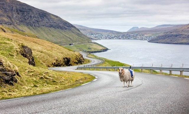
Google gives Faroe Islands a less woolly Street View
Google finally sent a team equipped with 360-degree cameras and a Street View trekker last week

Sheep view Camera PHOTO: VISIT FAROE ISLANDS
She'd equip 360-degree cameras to capture the North Atlantic archipelago that was undocumented by Google Street View. "My sheep are great for capturing the tracks and trails of the Faroe Islands but in order to cover the big sweeping Faroese roads and the whole of the breathtaking landscape, we need Google to come and map them," Andreassen wrote.
Google explains why Palestine isn't labeled on Maps
Last week, Google finally responded by sending a team with 360-degree cameras and a Street View trekker to help assist Andreassen's Sheep View project and capture slightly less woolly Street View imagery.
 PHOTO: VISIT FAROE ISLANDS
“When we heard about the Sheep View project, we thought it was shear brilliance. So we decided to help the Faroese by supplying them with a Street View trekker and 360 cameras via our Street View camera loan program,” Google said in a blog post.
Google launches food ordering in India
“Now that the Faroe Islands are supplied with a Trekker and 360 cameras, residents and tourists can assist the sheep in collecting Street View imagery of their beautiful lands using selfie-sticks, bikes, backpacks, cars, kayaks, horses, ships and even wheelbarrows.”
Andreassen's blogpost has also inspired others to map the islands. Peter NeuBauer, co-founder of the photo map service Mapillary, along with his son visited the Faroe Islands after hearing about the Sheep View project.
 Sheep used to map Faroe islands PHOTO: VISIT FAROE ISLANDS
In a blog post, Neubauer wrote, “We were thinking of going to Jotunheimen, in Norway, when we read about the Faroe Islands’ petition to bring Google Street View to their streets, and the resulting Sheep View project. How cool! we thought — that’s exactly the Mapillary spirit!”
A buggy alternative to Google Maps just launched in Pakistan
For five days, the father and son duo drove across the islands, with a camera rig snapping photos filling in the missing pieces of the Faroese landscape.
https://www.youtube.com/watch?v=GKUluG2eWWo


COMMENTS
Comments are moderated and generally will be posted if they are on-topic and not abusive.
For more information, please see our Comments FAQ