
Upon exiting the airport, I met my guide Mohammad Bashir, a polite Balti man from Skardu, and we began our journey immediately. In this blog, I will take you through one of the highest mountain ranges in the world – the Karakoram – on the engineering marvel known as the Karakoram Highway.
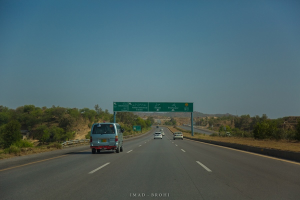 Driving through the plains of the capital
The first few hours were nothing extraordinary – plain greens of greater Islamabad. We passed Hawelian and Abbottabad along the way, but the real fun started after Balakot. The route ascends steeply following River Kunhar, as the mountains get higher and greener.
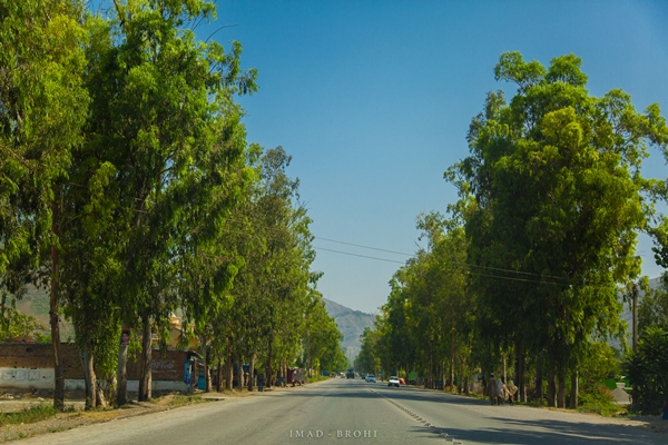 Passing through Hawelian
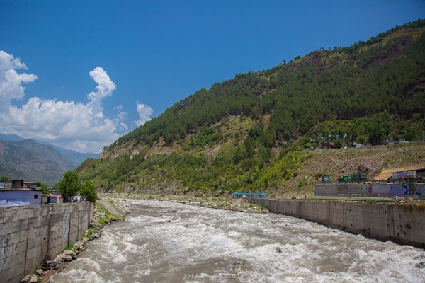 Crossing Balakot Bridge over River Kunhar
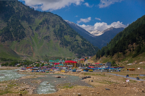
We reached Naran at roughly 3:00pm and pushed for Raikot, which is another three hours from Naran. If you have the time, I would recommend staying in Naran and exploring the beautiful Lake Saiful Mulook there.
Half an hour – some 60 kilometres – from Naran lies the beautiful Lulusar Lake. The lake is visible from the road and is the source of River Kunhar. After the lake, the road continued its steep ascent passing through glacial spurs, until we reached the Babusar Pass at 4:25 pm. The pass lies at 3,900 metres and connects the provinces of Khyber Pakhtunkhwa (K-P) and Gilgit-Baltistan (G-B). The sudden increase of elevation is likely to bring on headaches and feelings of dizziness.
 Naran
Naran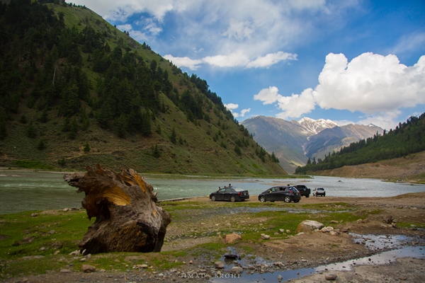 Families enjoy a day out along the banks of River Kunhar
 Shogran
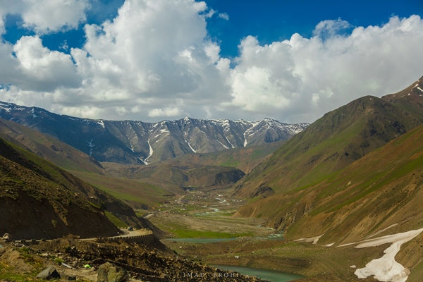
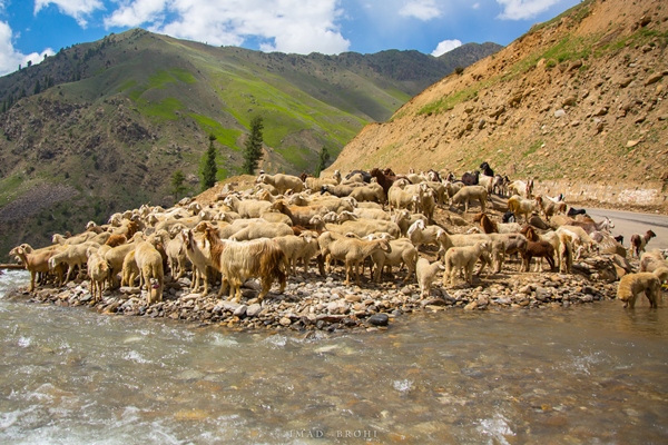 A herd of goats and sheep gather for a drink
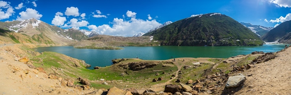 Lulusar Lake can be seen from the highway
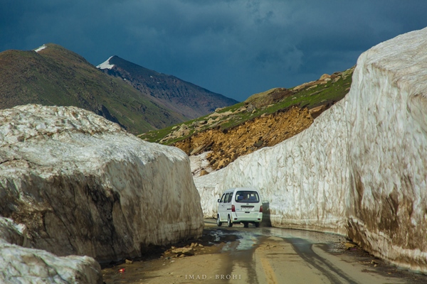 A car passes through a glacial spur in Lulusar-Dudipatsar National Park
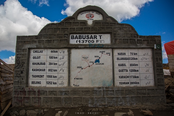 Monument at Babusar Top
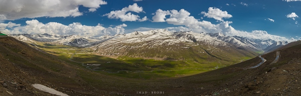 Babusar Top
As the road descends again, the mountain scenery completely changes, with fewer greens on this side of the pass. The road follows the Thak Gah stream until it reaches a T-junction where the stream connects with River Indus. From the junction, the route heads east to Chilas and west to Raikot.
We reached Raikot at around 6:30pm, which is a popular junction for those travelling to see Fairy Meadows or Nanga Parbat. We stayed overnight, with the only other tourists being a young couple from Japan.
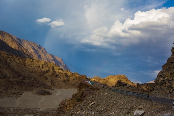 Crossing into Gilgit-Baltistan heading towards Chilas
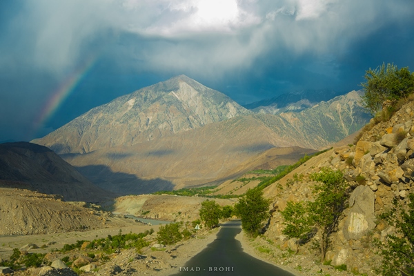 A rainbow appears in the sky after a brief period of rain
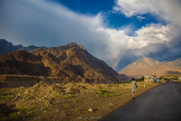
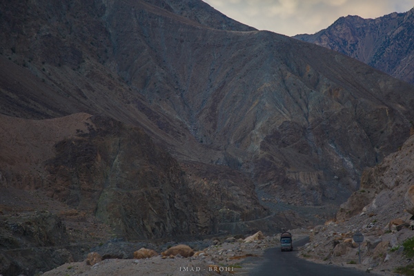 A truck carrying goods on Karakoram Highway just before Raikot
The next day we left early in the morning for Khunjerab, which was 330 kilometres away. However, the road from Raikot is in very good condition.
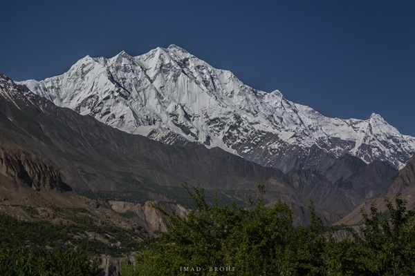
Just 30 minutes from Raikot, you can see Nanga Parbat in the background. Roughly 35 kilometres from Raikot is the confluence of the Indus and Gilgit rivers. It is where three of the greatest mountain ranges meet: Hindu Kush on the left, Karakoram in the center and the Himalayas on the right.
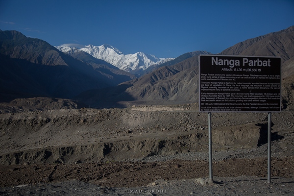 View point for Nanga Parbat
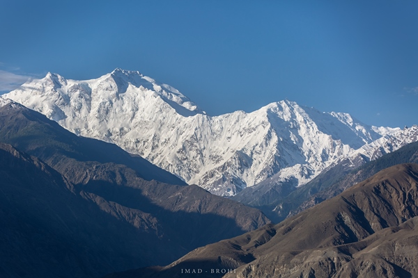 Summit View of Nanga Parbat
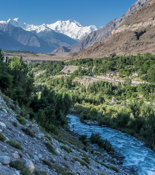
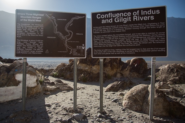 Signboards at the Confluence of Indus and Gilgit Rivers
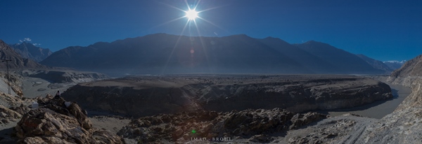 Confluence of Gilgit-Indus Rivers and the meeting point of three greatest mountain ranges in the world
Over a 100 kilometres from Raikot, the 7,788 metres high Rakaposhi – another popular mountain – is visible from the highway. After a brief stop, we continued our journey, passing Hunza and enjoying the view of the Hisper Mountain. We reached Attabad at 10:00am.
 Rakaposhi, as viewed from Karakoram Highway
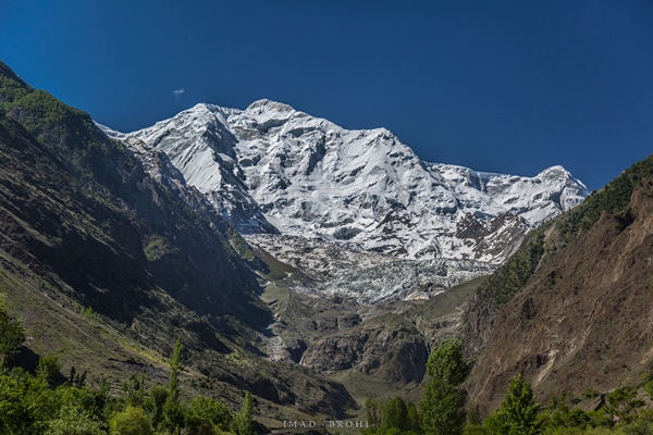 Rakaposhi summit view
In January 2010, a massive landslide blocked the flow of River Hunza, causing a lake to form. The subsequent lake submerged several villages and parts of the Karakoram Highway, displacing thousands of people. Initially, boats were used for transport across the lake, but the highway was eventually realigned and tunnels were built high up on the slopes of the mountain. The same boats are available for rent now.
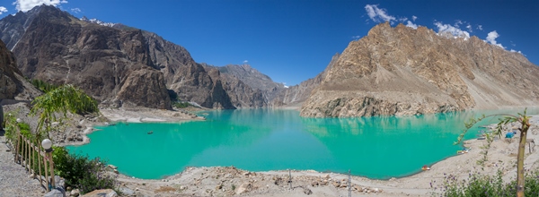 Attabad Lake as seen from Karakoram Highway
 Boats available for rent
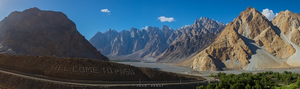
Passu lies 25 kilometres from Attabad, and is home to the beautiful Passu Cones. These stacks of triangular rocks form a mountain range roughly 6,000 metres in elevation, and are easily visible from the highway. We stopped by at several places to view them at different angles. Tourists can stay in Passu and also visit the Batura Glacier, which is nearby. Forty kilometres from Passu lies Sost, a major trade hub between Pakistan and China.
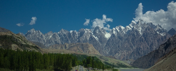 The magnificent Passu Cones are visible from the highway
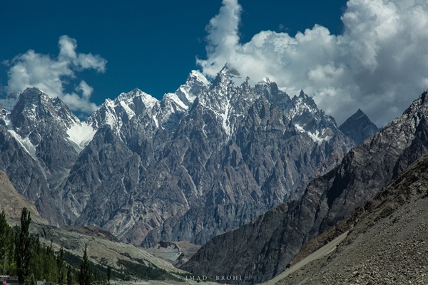 Passu Cones or Passu Cathedrals get their name from the stacks of triangle shaped rocks forming the mountain massif
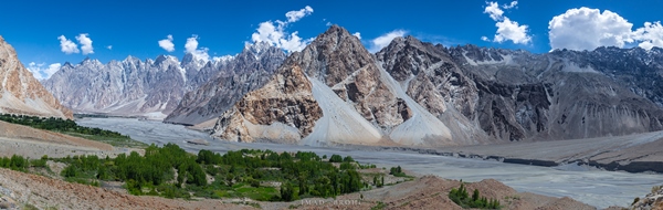 A panoramic view of Passu Cones from the Karakoram Highway
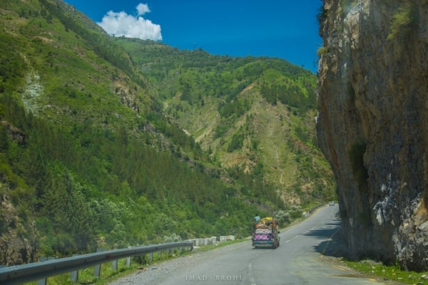
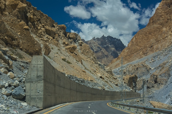
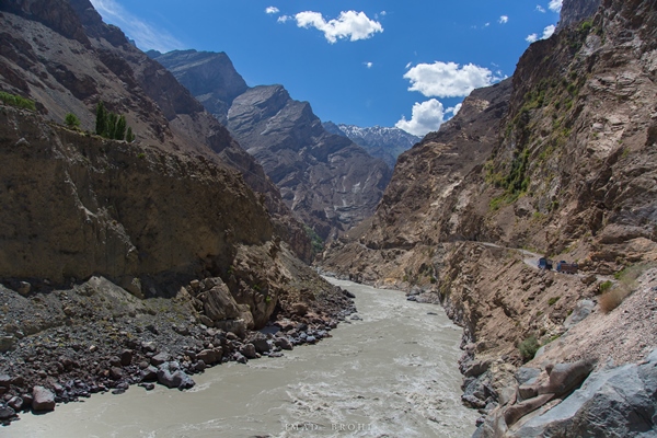
After Passu, the route passes through what appears as canyons, with the highway cut between massive mountainous walls. It truly is a remarkable example of nature’s strength (Karakoram Range) versus man’s ingenuity and perseverance (the Karakoram Highway).
A security check post and a park entrance office marks the beginning of the Khunjerab National Park, the first national park built in G-B and home to precious wildlife, including the snow leopard, Marco Polo sheep, the brown bear and ibex. The national park also resides at the Khunjerab Pass, the Pakistan-China border.
Once in Khunjerab, there lies sand near the mountains and you can feel the sky appearing much darker than usual. At the border lies the Pak-China border monument, where Pakistani and Chinese military officers as well as visitors from across border were seen exchanging jokes. It truly was a heart-warming experience; a signature of true friendship between two great countries.
At Khunjerab Pass, which is at 4,700 metres, we were now at the highest paved highway in the world.
 Walls built on the highway to protect the Karakoram Highway from sliding rocks and sand
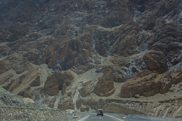 A vehicle moves towards Khunjerab with imposing mountain walls
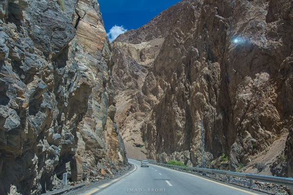 After some distance, the valley thins almost appearing like a canyon
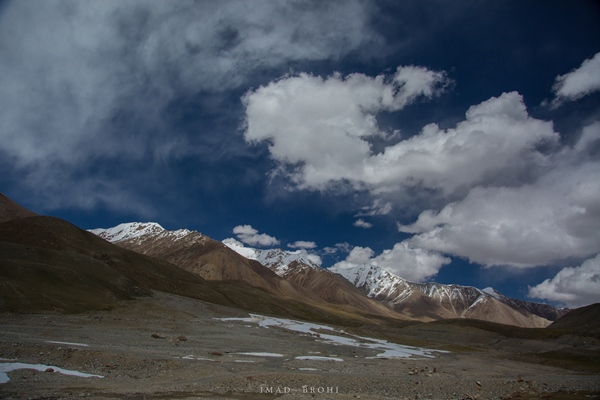 View from the top of Khunjerab Pass
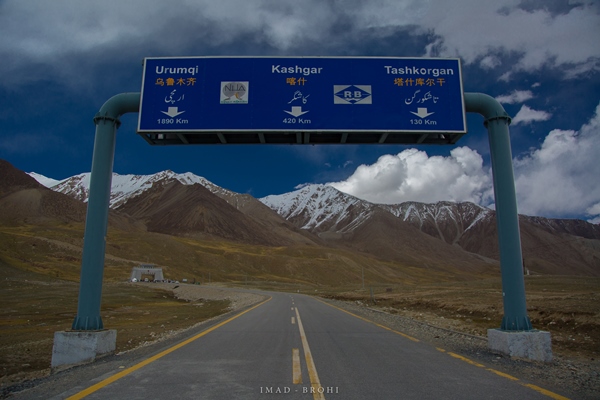 Arriving at Pakistan-China border at Khunjerab Pass
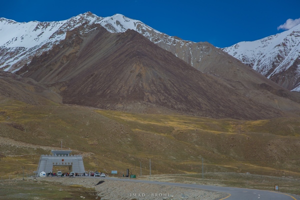 The Pakistan-China border monument from a distance
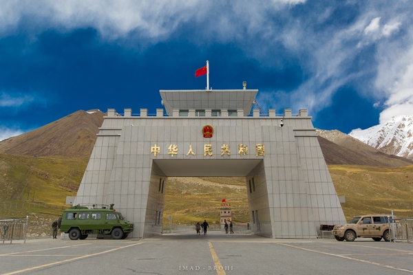 Chinese tourists run towards the border at Khunjerab Pass. The border monument is built on the Chinese side
After Khunjerab, we returned to spend the night in Hunza, stopping in Passu to visit the popular Hussaini Bridge. We arrived at Hunza at 6:30pm, after travelling some 200 kilometres from the border. In Hunza, we made a quick stop at Eagle’s nest, a viewpoint from the top of Hunza.
 The town of Passu
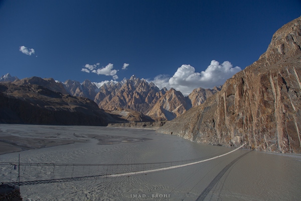 Hussaini Bridge near Passu
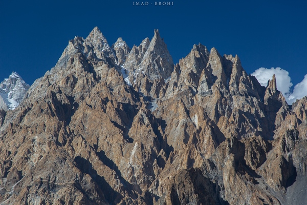 Summit view of Passu Cones
 Evening falls on Attabad Lake
Hunza reminded me of the Namche Bazar in Nepal. There are several hotels, cafes, restaurants and souvenir shops to enjoy. There are also two forts, Altit Fort and Baltit Fort, which we wanted to visit but couldn’t due to time restrictions. I would recommend one to spend at least two to three days in Hunza to experience this beautiful town.
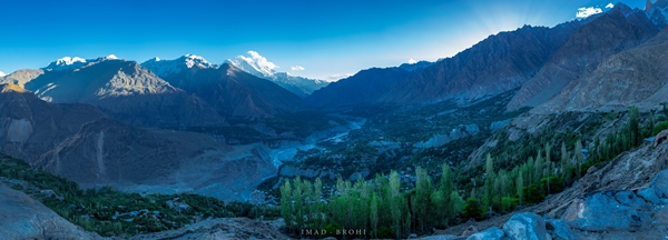 Hunza Valley seen from Eagle’s Nest
On day three we left for Skardu early in the morning. The 300-kilometre distance takes around eight to 10 hours to complete, due to poor road conditions. After hitting the Karakoram Highway, the route heads east passing Sikandarabad, and then turns south near Nagar. It’s a single road, heavily deteriorated in places. We lost a good 45 minutes in Malupa to clear a landslide, finally reaching Kachura, near Skardu, and it took us 10 hours to cover these 285 kilometres.
 Rakaposhi from Karakoram Highway
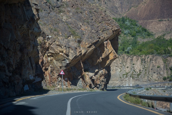
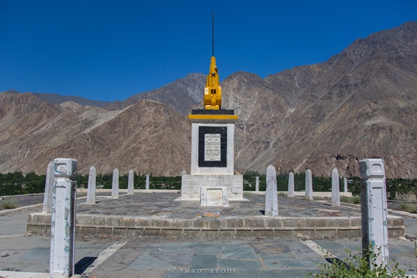 Memorial built to honour those who laid down their lives in the construction of Karakoram Highway
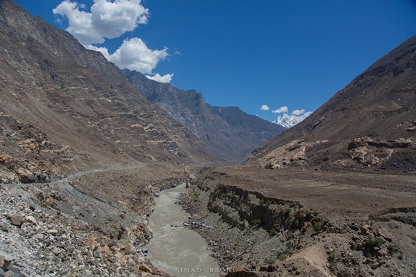 The road to Skardu
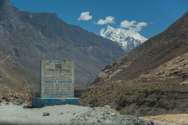
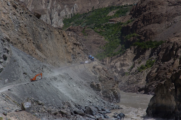 Cars wait patiently as crane clears road off landslide debris at Malupa
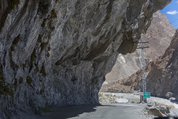 The road to Skardu
We spent a day exploring Skardu, starting by visiting the Upper and Lower Kachura Lakes.
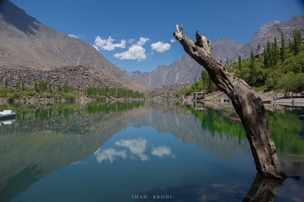
Lower Kachura Lake is popular due to the Shangrila Hotel built there. If you are not staying at the lake, then a nominal fee will get you near it. The lake’s beauty lies in its location, with the mountains of Skardu in the backdrop.
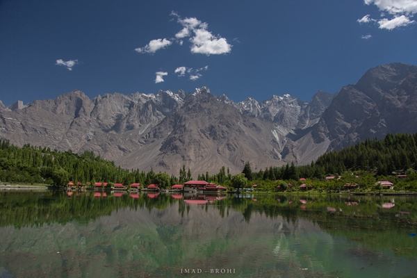 Lower Kachura Lake with mountains of Skardu in the back drop and Shangrila Hotel at the lake front
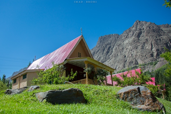
For a more remote setting, I would recommend the Upper Kachura Lake, which is roughly seven kilometres from the Lower Kachura Lake. There is a guesthouse and a cabin built up there for travellers to stay in.
 Upper Kachura Lake is more quiet and remote due to its location
After the two Kachura lakes, we drove to Kharmang, where we enjoyed the very scenic Manthoka Waterfall. There is a clear stream of cold, fresh water running and you can enjoy some tea or snacks with the pleasure of viewing the abshar (waterfall).
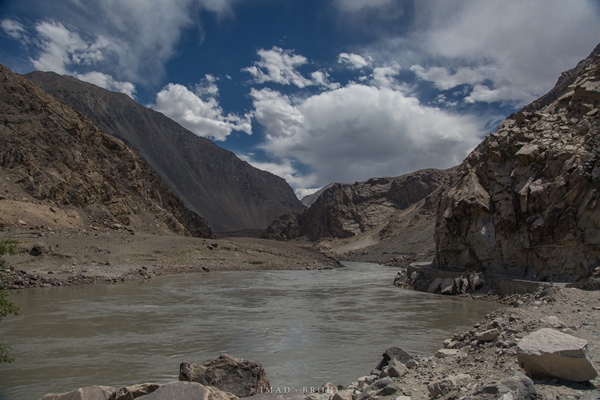 The track to Kharmang follows River Indus
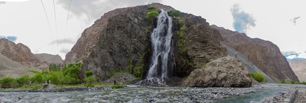 Manthoka Waterfalls in Kharmang is a hidden gem of nature
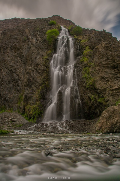
We reached our Pakistan Tourism Development Corporation (PTDC) motel at around 5:00pm, ending this most wonderful road trip. I have experienced many road trips, including the Middle East and North America, but the trip along the Karakoram Highway is unparalleled in its raw beauty.
Trip stats
| Islamabad | Raikot | 11 hrs | 430 kms | Balakot, Shogran, Naran, Saiful Mulook, Lulusar/Dudipatsar Lake, Babusar Pass |
| Raikot | Khunjerab, Hunza | 13 hrs | 520 kms | Nanga Parbat, Indus-Gilgit Rivers Confluence, Rakaposhi, Attabad Lake, Passu Cones, Batura Glacier, Khunjerab National Park, Pak-China Border, Hunza/Karimabad, Eagles Nest in Hunza, Altit/Baltit Forts |
| Hunza | Skardu | 10 hrs | 285 kms | Upper/Lower Kachura Lakes, Sadpara Lake, Kharpocho Fort |
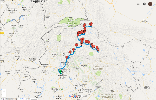
You can follow the journey here.
All photos: Imad Brohi

COMMENTS
Comments are moderated and generally will be posted if they are on-topic and not abusive.
For more information, please see our Comments FAQ