Detecting fraud: New GIS lab to make life tough for encroachers
Punjab’s Urban Unit providing technical assistance to CDA in reorganising capital’s land records.

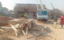
The GIS lab will be conducting satellite surveys of CDA land in a bid to avoid complications the civic agency used to face at the hands of encroachers. PHOTO: FILE.
The Urban Unit, Punjab, has been providing technical assistance to the CDA’s GIS lab in computerising new and reorganising old land records.
Under a Memorandum of Understanding signed by CDA Chairman Nadeem Hassan Asif and Urban Unit Punjab Chief Executive Officer Dr Nasir Javed, the unit is also providing manpower to support the civic agency.
The GIS lab will be conducting satellite surveys of CDA land in a bid to avoid complications the civic agency used to face at the hands of encroachers prior to the announcement of land acquisition and built-up property awards, especially of residential areas.
The lab will ensure transparency in the acquisition of land for the development of new sectors in the capital.
The Urban Unit’s GIS sector envisages developing urban areas as the engines of growth and sustainable development. The sector has been developing a GIS based multi-user enterprise level spatial database named “IRIS” as a decision support tool, through which quality information can be provided to provincial and local governments.
IRIS aims to develop a GIS-enabled spatial database with an urban profile, land use mapping, infrastructure, and service delivery profile.
The CDA and Urban Unit will implement a three-point plan for the acquisition of land in the future. Under the strategy’s first phase, the CDA will gather information from local land owners.
During the second phase, a land survey will be carried out via the unit’s satellite technology. In the final phase, a detailed topographic survey of the area will be conducted to ensure transparency in the land acquisition process.
CDA Planning Wing Additional Director Arshad Chohan has been nominated as the focal person who will coordinate with the satellite survey experts.
Four Urban Unit experts have also been deployed to the CDA’s GIS lab.
Usually, within days of the civic agency announcing the acquisition of land for a new sector, land grabbers build temporary structures within the areas in question and claim compensations against the land on which the illegal buildings have been set up.
Published in The Express Tribune, September 16th, 2013.


COMMENTS
Comments are moderated and generally will be posted if they are on-topic and not abusive.
For more information, please see our Comments FAQ