The Netherlands: the safest delta in the world
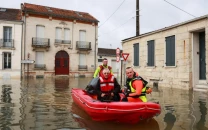
Some 26 percent of country lies below sea-level, including Schipol airport

PHOTO: AFP
These are some of the key ingredients which allow the Netherlands to boast that it is the "world's safest delta".
Geography
The Netherlands is essentially a large delta traversed by three major rivers - the Rhine, the Schelde and the Maas - which all flow out into the North Sea.
Climate change: Karachi could submerge by 2060, Senate panel told
Some 26 percent of country lies below sea-level, including Schipol airport - Europe's fifth busiest air hub. And about 60 percent of the territory is classified as at risk from flooding.
More than half of the nation's 17 million people live in these at-risk low-lying areas, where 70 percent of the country's gross domestic product is produced.
Polders and terps
In the battle to keep the tides at bay, Holland is dotted with hundreds of artificial earth mounds, called terps, on which the Dutch have built homes, farms and even whole villages.
Some of these terps date back as far as 500 BC, and are the among the first traces of man's attempt to conquer the seas.
About 18 percent of the country's territory also stretches across polders - swathes of reclaimed land encased and protected from the waves by a series of dykes.
Storm barriers and the delta plan
After a catastrophic flood in 1953 left almost 2,000 people dead, the Netherlands put in place the so-called "Delta Plan" to secure those areas most at risk.
Back then, sea defences were overwhelmed and dykes crumbled in the face of heavy storms, deluging large swathes of the southern province of Zeeland.
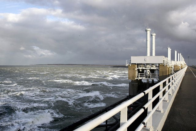
 PHOTO: AFP
Several storm surge barriers were built and are used to seal off estuary mouths during heavy weather.
The most impressive of these is the famous Eastern Scheldt storm surge barrier, opened in 1986 and which this year served as the finish line for the Tour de France's first stage.
Middle East could be uninhabitable by 2100
Almost nine kilometres (five miles) in length, this barrier has 64 metal "doors" - each around 42 metres wide - which can be closed when the land is threatened by rising tides or storm surges.
Giant lakes
Completed in 1932 and still regarded as a remarkable feat of civil engineering, the Afsluitdijk (literally the "close-off" dyke) spans 32 kilometres of water over a gulf.
This dyke secures hundreds of kilometres (miles) of inland coastline inside its boundaries, creating the vast but shallow IJsselmeer which quickly turned to fresh water.
Across the dyke stretches a multi-lane highway providing a shortcut between North Holland and Friesland, allowing travellers to cut almost 300 kilometres from their journey.
Massive wave machine
As in many areas, the Dutch are front-runners in the field of wave research and finding ways to protect against rising waters.
The latest weapon in the anti-water arsenal is a giant machine able to create a five-metre high wave - the world's largest. The wave is used to test real-scale dykes and sand dunes.
How geography impacts policy
Four powerful pistons behind a seven-metre high metal plaque push water down a channel. Next to the channel is a reservoir with nine million litres of water -- equivalent of four Olympic swimming pools - which can be pumped into the channel at 1,000 litres a second.
The aim of the 26-million euro ($29-million) project is to simulate the power of the oceans, and recreate tsunami conditions to help build better, stronger flood defences.


COMMENTS
Comments are moderated and generally will be posted if they are on-topic and not abusive.
For more information, please see our Comments FAQ