Envisioning North Nazimabad as a socially vibrant urban space
Students of NED University were assigned to study a micro-urban area for in-depth investigation and analysis
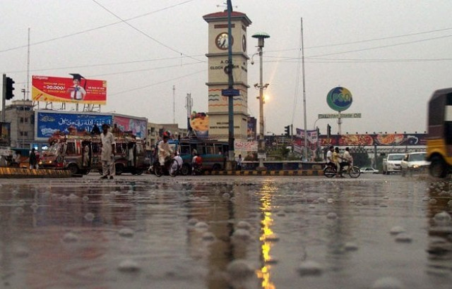
PHOTO: EXPRESS/ Mohammad Noman
The CED studio module was introduced in 1979 in the Bachelor of Architecture programme at the Dawood College of Engineering and Technology, Karachi, which was the only architecture school in the city at the time. According to Dr Noman Ahmed, the chairperson of the department at the NED University, a key objective of this studio module was to sensitise budding architects about the context of the built environment.
Students were assigned to study a micro-urban area for in-depth investigation and analysis, concluding with analytical presentations that also included basic proposals for addressing problems identified in the studio exercise. Starting from Dawood College, the module has now been adopted by many architecture schools in the country including the NED University, Karachi.
This module had multiple impacts — understanding the realities behind the creation of the urban built environment, the realisation of multiple roles for professional contribution in the ongoing metamorphosis and the appreciation of diverse fields of studies within the domain of architecture.
Group exercise
This year, the batch of 2010-11, in their CED, took up the challenge of documenting, analysing and designing 14 blocks in North Nazimabad — Blocks A-N — supervised by Dr Noman Ahmed and Rahat Arsalan. The class was divided into four groups — history, evolution and physical; sociological profile; economic development and governance; and infrastructure, institutional profile and area management.
History dealt with the evolution of the area, the means and measures of its development and growth over the period of time as well as the factors and reasons for the change. The social group began with understanding the sociological history of the area, the factors and causes that had resulted in the current societal norms and lifestyle of North Nazimabad. Economic development catered to the documentation and analysis of the professional and economic expansion of the area, highlighting the opportunities of work and livelihood. Infrastructure not only covered the road network, drainage, transportation and communication aspects of the area, but also analysed these services on a broader spectrum, investigating the controls of governance and management and their role in building communal norms, their progression with time and the change in its need and requirement.
The most important aspect of the analysis phase was the numerous site visits carried out by the students, giving them an in-depth understanding of the area with regards to the stakeholders, infrastructure, lifestyle and culture, and the growth and development aspects.
Proposals
The final phase consisted of design proposals where the students had to give a vision for their respective scenarios on the basis of the entire process of study. They were asked to assume radical, moderate and no-change scenarios, where all groups had to state their propositions with suitable justifications and solutions for the problems they had highlighted during the analytical procedure of the exercise.
In the case of the physical built environment part, the vision was to revitalise North Nazimabad as the primary cultural, commercial and community core to serve the surrounding neighborhood users and visitors. A commercial connectivity centre was proposed at Hyderi, acting as a magnet for surrounding neighborhood users and visitors to promote cultural, tourist and community activities.
Overall, three distinct proposals evolved. In one proposal, the students assumed that very little change in the governance and surrounding situation shall arise. Their design thus focused on safeguarding public spaces, conserving the green belt along Sharae Sher Shah Suri and reorganising the various vendor bazaars and concentrations.
The second proposal accommodated moderate changes in the governance and systems in the future, featuring the rationalisation of building heights, amalgamation of plots before multi-storeyed constructions and restriction of physical interventions in designated public parks.
The third proposal looked at interventions from a radical perspective. This group adjusted the proposed BRT corridor in the green belt, created overpasses and underground links for horizontal connectivity and adjusted roadside parking to suit the emerging requirements.
The writer is an urban planner and runs a non-profit organisation based in Karachi city focusing on urban sustainability issues
Published in The Express Tribune, June 8th, 2015.






COMMENTS
Comments are moderated and generally will be posted if they are on-topic and not abusive.
For more information, please see our Comments FAQ