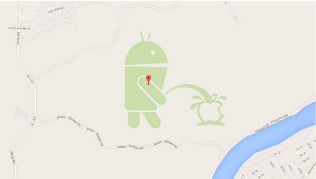
The image, reportedly an Easter egg added by a Google employee or data provider, remains visible on Google Maps itself. While some parts of Google’s mapping data are user-editable, the base terrain information isn’t, suggesting that whoever inserted the image has privileged access.
The image can only be seen on the Map view in Google Maps — switch to Earth (satellite) view, and it's gone.

Screengrab of Google maps
Speaking to Mashable, a Google spokesperson explained that the image is likely a result of a user abusing Map Maker, the tool that allows everyone to contribute to Google Maps.
"Even though edits are moderated, occasionally the odd inaccurate or cheeky edit may slip through our system," he said.
"We've been made aware of the issue and are working on getting it removed," he added.


COMMENTS (1)
Comments are moderated and generally will be posted if they are on-topic and not abusive.
For more information, please see our Comments FAQ