‘Karachi needs preventive measures not response mechanisms
The massive inner city flooding in 2006 resulted from irregular and illegal land utilisation practices.

‘Karachi needs preventive measures not response mechanisms
Karachi does not experience a high level of rain and recorded precipitation (rainfall) data in Karachi from 1914 to 2010 indicates that, while there is a high level of variability, there is no significant change in average precipitation.
Karachi has, however, experienced severe floods, which have occurred periodically. According to a 1981 Karachi Development Authority report, severe floods occurred in the flood plains of the Malir and Lyari rivers in 1977, resulting in 267 deaths, causing more than 30,000 people to become homeless, and leading 100,000 others to be made temporarily dislocated. More recently, the city experienced severe inner city flooding in 2006.
The problem in effectively dealing with urban flooding is not in fact failure to accumulate proper data and place prior warning systems for such events. The Pakistan Meteorological Department issues daily, weekly and seasonal forecasts.

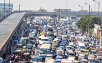
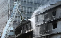
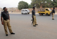
‘Flood Risk Maps’ can help identify vulnerable assets and communities, and improve the design of the city’s drainage network. PHOTOS: FARHAN ANWAR
The national space agency, the Pakistan Space and Upper Atmosphere Research Commission, also engages in monitoring and documenting climatic data on a regular basis with the help of remote sensing, geographic information systems and natural resource surveying. Organisations, such as the National and Provincial Disaster Management Authority have also developed plans to respond to an urban flooding crisis.
In the case of Karachi specifically, the Karachi Water and Sewerage Board has also chalked out a ‘Rain Emergency Plan’ as a precautionary measure even though it is not actually mandated to look after the city’s drainage system.
The water board’s plan is to maximise the efficiency of its sewer cleaning system that may overflow during the rainfall.
Response mechanism vs preventative measures
The problem is that these plans are more response mechanisms and less preventative measures, which is what is essentially needed to reduce the damage impact. Moreover, the way the city is developing without any planning or environmental safeguards, the associated complications are not fully factored in the contingency planning systems.
According to the Karachi Strategic Development Plan 2020, some critical reasons for the massive inner city flooding experienced in 2006 are the irregular and illegal land utilisation practices in the past.
The report says that the nullahs and low-lying areas, which were left as open areas were converted into developed lands notwithstanding the requirements of providing alternative and man-made disposal channels and this disturbed the natural flow conditions and resulted in uncontrolled storm drainage patterns, especially during rain and high intensity storms.
The report further states that a large amount of solid waste is regularly disposed in the open storm drainage channels, which results in complete or partial choking of the flow conditions during a storm.
Flood risk maps
What we need is a long-term plan. ‘Flood Risk Maps’ need to be developed to identify vulnerable assets and communities and improve the design of the city’s drainage network. It is also important to have a strict policy or regulation to prevent settlements from forming in the river bed and hills, encroachment of drainage channels and to increase the ‘green cover’ of the city to facilitate drainage and provide protection against tidal flooding.
Vulnerable settlements
The consequence of a flood is determined by who and what is exposed to a flood. One way of identifying risk is by developing a ‘Flood Risk Zone’, which has yet to be done. Even in the absence of such data, it is clear that in Karachi there are a significant number of vulnerable human settlements that are residing in possible flood-risk zones. These include
• Katchi abadis: They represent the most recognisable face of informal settlements in Karachi. Currently, about 61 per cent of the population is residing in such settlements and of these, a high proportion occupy undesirable real estate, such as the Malir and Lyari river beds.
• Low-lying localities: These areas house much of the wholesale business and commercial activities in the old city. Moreover, the commercial business district is also located here. These localities are densely populated and are low-lying, bound by the Lyari River and Karachi harbour.
• Hill settlements: Extensive settlements have taken place either on the hills dotting the Karachi landscape or on the foothills, which are at risk of hill torrents and possible landslides.
The writer is an urban planner and runs a non-profit organisation based in Karachi city focusing on urban sustainability issues. He can be reached at fanwar@sustainableinitiatives.org.pk
Published in The Express Tribune, June 30th, 2014.


COMMENTS
Comments are moderated and generally will be posted if they are on-topic and not abusive.
For more information, please see our Comments FAQ