Tallest waterfall in Hazara Division obscured by neglect
The location can be developed into a tourist attraction, help generate revenue and jobs.

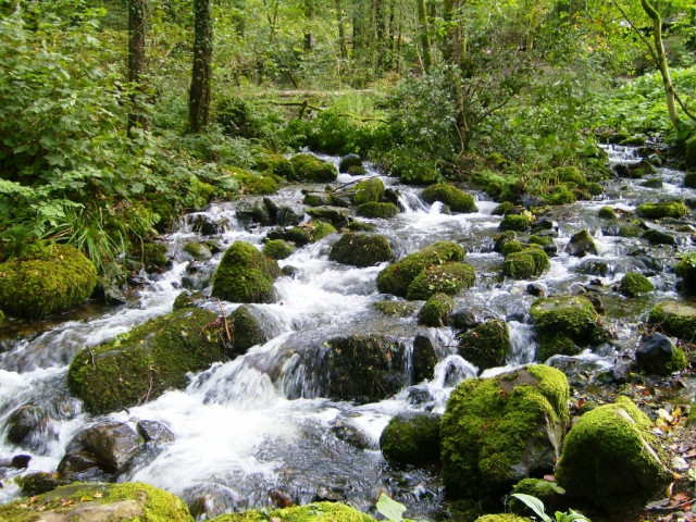
Haripur District is gifted with a plethora of picnic spots where people can break away from the humdrum of routine life. A 400-metre-high waterfall in the outskirts of Chajian village is one of them but remains inaccessible due to absence of road links.
If developed properly, such areas can attract tourists and help generate revenue and provide jobs for the locals.
“It’s a beautiful picnic spot and I bring my family here at least once a month,” said Wajeehul Hassan, an environmentalist. He added that he enjoys hiking on tough terrains and cooling down by the waterfall. However, he said it is not easy getting there due to absence of roads.
Hassan lamented that the tourism department has not invested in the area, which he claims has a huge potential for tourism.
The waterfall is located on the outskirts of the remote village, some 45 kilometres south-east of the district headquarters. The district’s highest peak, Siribang, overlooks the waterfall, which is fed by natural springs. The flow of fresh and clean water further sinks into Haro River, about 5 kilometres downstream. Before joining the river, the waterfall helps operate four watermills which locals mainly rely on to obtain flour.
Chajian village, which is surrounded by green hills and houses over 3,000 people, has large reserves of minerals, forests and springs. A small distance from Khanpur Dam, it takes about three hours from the village to reach Islamabad’s hill-top garden Daman-e-Koh on foot.
According to Ronaq Zaman, a social worker, the waterfall continues to feed the river throughout the year except winter when there is snowfall and the springs get choked. During monsoon, rainwater mixes with the waterfall, increasing its flow and enhancing its beauty.
“The waterfall has been serving as one of the tributaries of Haro River for over 100 years,” said Malik Akhtar, a businessman. He added that the area could be linked to Islamabad from the southern side of the waterfall, whereas from the western side, a 3km road could be extended to it from Dartian village, on the side of Khanpur Lake. Akhtar further said that if developed properly, the Khanpur Dam and Chajian waterfall could attract tourists from across the country and help improve livelihoods of the locals.
He said that being a peaceful area, it could also facilitate paragliders to practice and enjoy the heights of surrounding hills of the village. Abdul Rasheed, another local, said that the village only has a narrow road from Haripur which was built decades back, but was never blacktopped. Due to this, picnickers avoid visiting the area despite being interested in seeing the waterfall. He said that if the road network is built, the location could bring prosperity to the area.
Published in The Express Tribune, October 2nd, 2012.


COMMENTS
Comments are moderated and generally will be posted if they are on-topic and not abusive.
For more information, please see our Comments FAQ