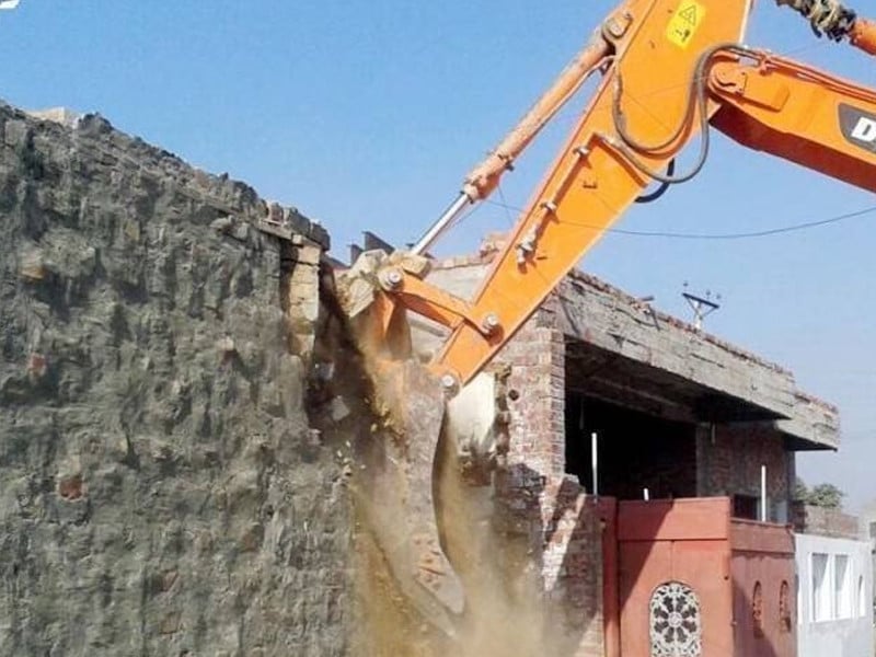
A survey conducted by the Pakistan Space & Upper Atmosphere Research Commission (SUPARCO) has uncovered widespread encroachments, building by-law violations, and illegal land use in key residential and commercial areas of the federal capital.
Utilising advanced satellite imaging technology, SUPARCO has provided a detailed report, including high-resolution imagery, to the Capital Development Authority (CDA).
According to sources, an important meeting to address these findings was held on Monday under the chairmanship of CDA Chairman Muhammad Ali Randhawa.
Attendees included senior officials from relevant departments, such as member planning and development, member estate, director general planning, deputy commissioner CDA, and director DMA.
The meeting agreed to take immediate action to tackle issues of encroachment, irregular settlements, and unplanned urban sprawl on CDA land. Key measures include enhanced monitoring, the sources said.
Chairman Muhammad Ali Randhawa directed the use of drones for continuous monitoring of urban development and land use. Real-time images from SUPARCO's geospatial technology will be leveraged to detect and prevent encroachments.
"A coordinated plan will be developed to address encroachment and building violations systematically, with specific timelines and Standard Operating Procedures (SOPs) for geospatial surveys," the meeting agreed.
The chairman instructed officials to focus on daily reporting and ensure close coordination across departments. "FIRs will be registered against individuals involved in illegal encroachments to deter future violations."
To prevent re-encroachment of cleared government land, a robust mechanism will be established, including real-time monitoring and strict enforcement. Modern technologies will be integrated into the land management system to ensure the proper use of government assets for the benefit of Islamabad's residents.
The meeting emphasised the extensive application of geospatial data to identify land use changes and maintain accountability. Continuous drone surveillance will bolster efforts to curb unauthorized developments and ensure compliance with building regulations.
Officials said the initiative will be a significant step in streamlining Islamabad's urban management and addressing long-standing issues of encroachment and illegal land use. The officials further said the CDA will ensure the protection of public land and sustainable urban growth in the federal capital.
The survey conducted by SUPARCO has highlighted several key areas of concern, including illegal constructions on public land, unauthorised commercial developments in residential zones, and widespread violations of zoning regulations. The use of satellite imagery has proven invaluable in identifying these violations, allowing for a clearer picture of the scale of the issue. The report provides detailed evidence of encroachments that had previously been difficult to document, ensuring a more targeted and efficient response from the CDA.
In the coming weeks, the CDA plans to implement a comprehensive public awareness campaign aimed at educating residents and businesses about building regulations and the importance of maintaining urban order. The authorities are also expected to collaborate with local law enforcement to ensure stricter enforcement of regulations. The goal is not only to remove existing encroachments but to prevent future violations by fostering a culture of compliance and civic responsibility.


1733227078-0/Untitled-design-(11)1733227078-0-270x192.webp)

1733207754-0/Untitled-design-(1)1733207754-0-270x192.webp)


COMMENTS
Comments are moderated and generally will be posted if they are on-topic and not abusive.
For more information, please see our Comments FAQ