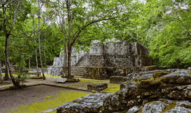
Archaeologists discover lost Mayan city with pyramids, plazas in Mexico
Valeriana was discovered by chance using Lidar, a type of laser survey that maps structures buried under vegetation.

Archeologists in Mexico have discovered a huge, lost Mayan city, which they named Valeriana, hidden deep in the southern jungle of Campeche – a sprawling, urban settlement, replete with architectural marvels and agricultural infrastructure.
Why it’s important?
The discovery of what appears to have been a bustling urban landscape challenges the existing knowledge about the prevalence and density of ancient Mayan settlements.
Valeriana was discovered by chance using Lidar, a type of laser survey that maps structures buried under vegetation.
Mr Auld-Thomas – part of the archaeology team – is a PhD student at Tulane university in the US and came across it by accident.
He processed the data with methods used by archaeologists, and saw what others had missed - a huge ancient city which may have been home to 30-50,000 people at its peak from 750 to 850 AD, added BBC.
“I was on something like page 16 of Google search and found a laser survey done by a Mexican organisation for environmental monitoring,” he was quoted as saying by BBC.
The dataset used for the study came from approximately 122 square kilometers (47 square miles) of high-quality airborne Lidar data collected in 2013 as part of a forest monitoring project called Alianza and led by the Nature Conservancy in Mexico, to reduce emissions from deforestation and degradation.
“We argue that the Alianza data demonstrate a range of ancient settlement densities comparable to those documented by site-focused archaeological survey in the region, from nearly vacant rural landscapes to dense urban areas,” said the researchers in the study, published by Cambridge University Press.
“The discovery of Valeriana highlights the fact that there are still major gaps in our knowledge of the existence or absence of large sites within as-yet unmapped areas of the Maya Lowlands.”
Lidar technology revealed a sprawling, urban settlement, replete with architectural marvels and agricultural infrastructure.
The classical-era Maya civilization dates back to the period between 250 and 900 AD, when it extended its dominion over present-day southern Mexico and what are now Belize, El Salvador, Guatemala and Honduras.
The analysis of the archaeological site yielded an aggregate settlement density of 55.3 structures per sq km. The researchers identified a total of 6,764 structures, hinting at a populous ancient city.
The researchers will carry out further detailed quantitative analysis of the archaeological features within the dataset and conduct field validation of their remote analysis. The discovery serves as a stepping stone for understanding the ancient Mayan urbanization and settlement patter.


COMMENTS
Comments are moderated and generally will be posted if they are on-topic and not abusive.
For more information, please see our Comments FAQ