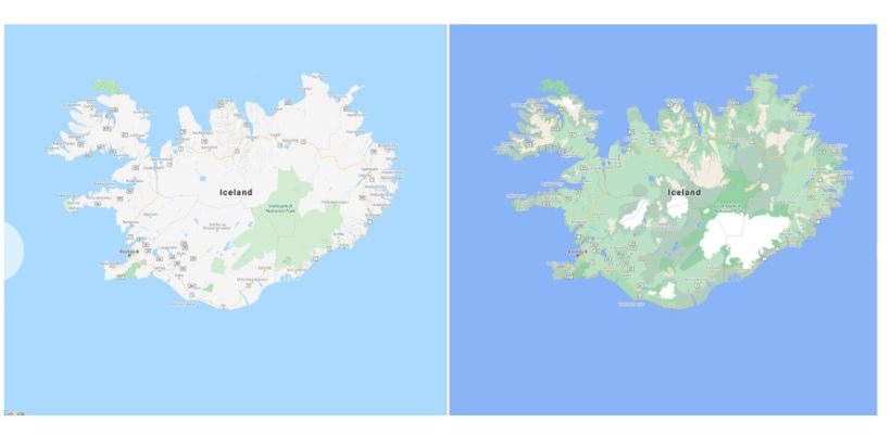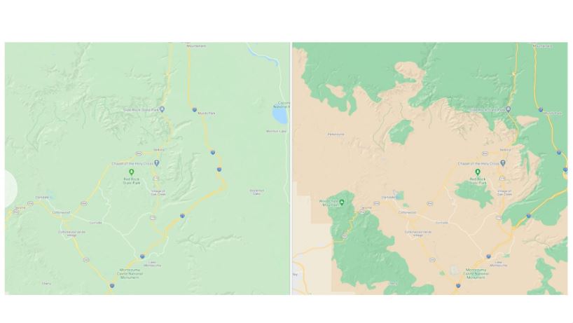
Google Maps is being redesigned with the goal of making it easier to distinguish between natural features in the environment, whether they are mountainous ice caps, deserts, beaches, or dense forests.
Pakistani researchers among winners of Facebook misinformation project
The company says it uses satellite imagery as the basis for its new maps that will be available in 220 countries. “With a new color-mapping algorithmic technique, we’re able to take this imagery and translate it into an even more comprehensive, vibrant map of an area at a global scale,” says the search engine giant.
Below are some comparison shots to give you a better understanding of the new color-mapping technique;


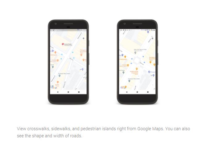
The new update is set to be rolled out this week and to be able to see the new changes users need to zoom-out. Moreover the redesign comes with highly detailed street information that shows the accurate shape and width of a road to scale.
Instagram kept deleted photos and messages on its servers for more than a year

The improved street designs for New York, San Francisco, and London are getting released in the coming months, with plans to add more cities over time.
Since its launch 15 years ago, Google Maps has become a powerful navigation tool, used by people every day around the world. With the addition of new visual improvements it will be easier to understand what an area looks like.
This article originally published on The Verge.


1719640649-0/BeFunky-collage-(77)1719640649-0-270x192.webp)


COMMENTS
Comments are moderated and generally will be posted if they are on-topic and not abusive.
For more information, please see our Comments FAQ