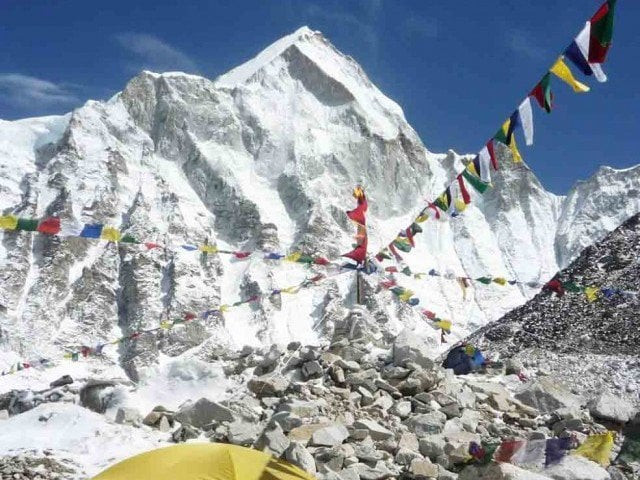
Height of the world's tallest peak under question
Geographical and climatic changes are suspected to have an effect on the height of Mount Everest

PHOTO: AFP
The height of Everest was initially calculated to be 8,840 meters when it was measured by British surveyor Sir George Everest, after whom the mountain is named. The figure was later adjusted to 8,848 metres in 1955, which remains the official height till date, according to CNN.
Ex-army officer becomes fourth Pakistani to scale Everest
"Since multiple scientific studies show that there might have been some changes in the height of Everest, it became the Nepali government's responsibility to check and clarify the matter," Ganesh Prasad Bhatta, director general of Nepal's Survey Department, told CNN.
He added that his office had been planning to re-measure Everest ever since 2012, but were unable to carry out the task. After the 7.8-magnitude earthquake in Nepal in 2015, the international scientific community expressed serious doubt about the peak’s elevation, which motivated Nepal’s Survey Department to begin the project. The endeavour is expected to cost $1.5 million to the government of Nepal.
A small group of technicians have begun work from a landmark in Nepal’s Udayapur district, which is approximately 1,500 meters above sea level.
"The team will collect info from stations that'll be set up every two kilometres starting from Udayapur all the way to Everest's peak," said Niraj Manandhar, head of Geodetic Survey branch in the department. "Each and every data point will be recorded to the closest millimetre for accuracy."
According to the Nepal’s surveyor general, work on the project will officially begin in mid-July.
Bhatta eventually aims to gather a team of 50 people by August, and says that he has also approached "foreign scientists and experts who have already been involved in similar measurements of different mountains around the world.”
The altitude of Mount Everest will be calculated using data derived from three mechanisms, namely levelling instruments, gravity meters and GPS. GPS, or global positioning system, would play a major role. A signal receiver would be placed at each station, and the team would observe the signals sent between the receiver and satellites. The time taken for the signals to travel this distance would be converted into a height measurement. The old trigonometric method of triangulation would not be used to measure the height. According to Bhatta, the final result would be arrived at after a two-year period.
Famed Swiss climber Ueli Steck dies on Everest
In 1999, an American team, backed by the US National Geographic Society, employed GPS to evaluate the height of Everest. According to their calculations, the peak is 8,850 metres high. However, the result was rejected by Nepal for not using government-approved measurement procedures. In 2005, a Chinese team computed the height of the peak to be 8,844 metres. Once again, Nepal refused to recognise the findings as the research was not authorised by the state.
Mount Everest stands on Nepal’s border with Tibet, but is officially in Nepal.
"It is not mandatory for Nepal government to get the results ratified by the Chinese side," said Bhatta.
As a gesture of goodwill, Bhatta’s team would offer the Chinese government to involve its experts in the project.


COMMENTS
Comments are moderated and generally will be posted if they are on-topic and not abusive.
For more information, please see our Comments FAQ