
“A geological survey will be carried out soon in areas of Gilgit-Baltistan where underground tremors are taking place,” said an official in the district administration on Monday. “The real cause of the tremors will be known after the survey,” said the official, who chose to remain anonymous.
People in Attabad in Hunza had time and again complained about tremors and fissures on the ground, asking the government to take measures to resolve the problem, but the request fell on deaf ears every time.
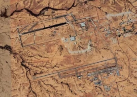
In January this year Attabad Village was submerged by an artificial lake caused due to a landslide that blocked River Hunza.
Following the Attabad Lake disaster, a number of other areas in Hunza-Nagar, Skardu and Ghizer valley have felt the underground jolts, creating panic among residents who demanded that a survey be carried out to discover the cause.
Home Secretary Asif Bilal told The Express Tribune that the reason for the tremors bellow surface was that many areas of Gilgit-Baltistan were located above the fault line.
More than 20 people were killed in the Attabad tragedy. Moreover, dozens of houses have been destroyed by landslides due to jolts. People in Miacher said that a huge fissure has also appeared on the surface of lands.
People of Khushbat, Ghizer and Rundo Skardu also voiced similar concerns, asking the government to take preemptive measures before they end up facing a situation like the Attabad disaster.
Published in The Express Tribune, December 21st, 2010.


COMMENTS
Comments are moderated and generally will be posted if they are on-topic and not abusive.
For more information, please see our Comments FAQ